
| Genre | Antique Map |
| Artist | Unknown Cartographer |
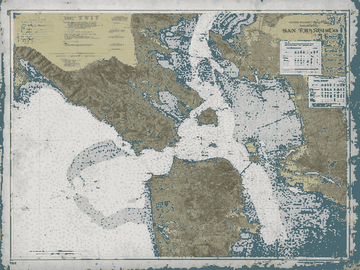
| Subject | San Francisco Bay Area Topography |
| Circa | 1850s–1870s |
| Medium | Giclée on 325gsm archival matte |
Vintage Bay Area Relief Map 19th Century California
Archive Print Co. · archival reproduction
We restore and reproduce forgotten masterworks of graphic design on museum-grade paper — so they can live on your walls instead of in an archive.
The Story Behind the Print
This meticulously restored relief map captures the Bay Area's dramatic topography as 19th-century cartographers first documented it with scientific precision. Created during California's rapid expansion following the Gold Rush, when San Francisco transformed from a sleepy village into a bustling port city, this map represents the era's urgent need to understand and navigate the region's complex geography.
The detailed topographical rendering reveals every ridge, valley, and waterway that defined the Bay Area's natural boundaries. Notice how the cartographer emphasized the dramatic elevation changes—from the rolling hills of Marin to the steep slopes of San Francisco itself. This wasn't just scientific documentation; it was essential infrastructure for a region experiencing unprecedented growth and development.
Reproduced on 325gsm museum-grade archival matte paper using giclée printing with archival inks, ensuring decades of fade-resistant beauty. Colors may vary slightly between screens and the finished piece — the print will always be richer.
From a Collector
“Third order from Archive Print Co. The paper weight, the linework — it’s the real thing. Framed it in dark walnut. Looks like it’s been hanging in a gallery for decades.”
James K. — Verified Collector
Read all 47 reviews →
Curated


