
| Genre | Archival print |
| Artist | U.S. Coast Survey |
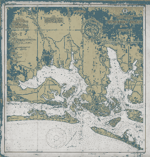
| Subject | Beaufort Inlet, North Carolina Coast |
| Circa | Early 20th Century |
| Medium | Giclée on 325gsm archival matte |
Beaufort Inlet Nautical Chart North Carolina Coast 20th Century
Archive Print Co. · archival reproduction
We restore and reproduce forgotten masterworks of graphic design on museum-grade paper — so they can live on your walls instead of in an archive.
The Story Behind the Print
This vintage nautical chart captures Beaufort Inlet along North Carolina's treacherous Outer Banks, where the Atlantic meets Pamlico Sound. Created in the early 20th century, this working chart guided mariners through one of the coast's most challenging passages, where shifting sandbars and hurricane-force winds claimed countless vessels over the centuries.
Beaufort Inlet served as a crucial gateway for commerce and fishing fleets navigating between the open Atlantic and the protected waters of the Sound. The precise depth soundings, coastal features, and navigational aids marked on this chart represent the meticulous work of U.S. Coast Survey teams who risked dangerous waters to create these essential maritime tools. Every line and notation could mean the difference between safe harbor and disaster.
Printed on 325gsm museum-grade archival matte paper using fade-resistant inks and professional giclée printing techniques that capture every detail of the original survey work.
Colors may vary slightly between screens and the finished piece — the print will always be richer.
From a Collector
“Third order from Archive Print Co. The paper weight, the linework — it’s the real thing. Framed it in dark walnut. Looks like it’s been hanging in a gallery for decades.”
James K. — Verified Collector
Read all 47 reviews →
Curated


